
Here is Frank Kummer at The Philadelphia Inquirer:
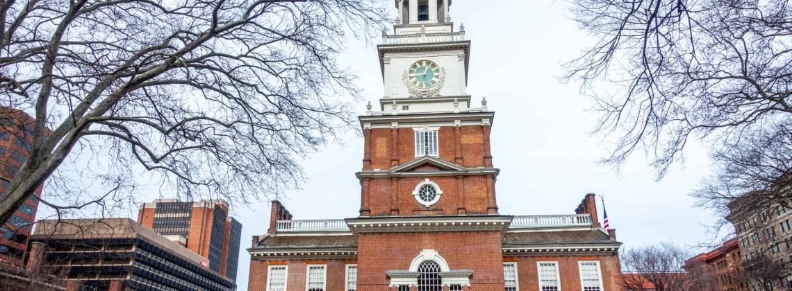
A group of Philadelphia-based organizations, led by Independence Historical Trust, has crafted a broad vision for the city’s historical area that calls for more walkable and bike-friendly streets, new plazas, additional green spaces, and easier navigation to cultivate a sense of cohesiveness they say is lacking.
The Historical Philadelphia Vision Framework plan aims to create ways for people to “wayfind” easy-to-follow, less car-centric routes through Independence National Historical Park, Old City, and other historic or local neighborhoods.
Better “pathways” would let tourists and residents know they are in an area branded as “historical Philadelphia.” New plazas, signs, public art, apps with digital tours, expanded sidewalks, mid-block crossings, live music, and additional seating would enhance the experience.
Planners identified six key locations: a new Tamanend Square Plaza set to be built at Second and Market, Dock Street, Commerce Street, Franklin Square, the WHYY / National Constitution Center area, and Market Street from Fifth to Third.
And this:
What are the key locations?
Second and Market / Tamanend Plaza
The already planned Tamanend Plaza is set for Second and Market Streets, including a “road diet” to accommodate new bike lanes. The statue depicting Chief Tamanend now at Front and Market would be moved to the new plaza and serve as its centerpiece in honor of the Lenni-Lenape, the Indigenous inhabitants of Philadelphia. The plaza would have pedestrian seating, a bikeway on both sides of Market, a new SEPTA station headhouse, and enhancements to Christ Church Park. The plaza is part of a larger project that calls for the transformation of Market Street in Old City by 2026.
Dock Street Plaza
Planners say Dock Street is underutilized and could serve as a gateway to Old City and Independence National Historical Park. They envision transforming Dock Street with an “inlaid stone cycling strip,” pedestrian seating, a canopy of festival lighting, a pop-up market zone, and mural art in the wedge of road between Positano Coast by Aldo Lamberti, Zahav, and Ritz 5. Planners say Dock Street provides a unique cobblestoned link to City Tavern, the Museum of the American Revolution, Welcome Park, the Merchant Exchange Building, and Bell Garden. Dock Street would lure artists, musicians, and historical programming one block from the I-95 park cap currently under construction.
Commerce Street to Carpenters Hall
Commerce Street, an unmarked brick alley, is mostly unused but could provide a near traffic-free path from Independence Visitors’ Center to historic Carpenters Hall, where the first Continental Congress was held in 1774. A speed bump mid-block on Fifth Street would connect Independence Visitor Center and Commerce Street. Plans call for another mid-block crossing on Fourth Street to Franklin Court. Fourth Street would get a bike lane, an area for “historical interpretation,” and signs branding it as part of historical Philadelphia. The “Commerce Pathway” would help connect people to Christ Church Burial Ground, Commodore Uriah Phillips Levy Park, and the Faith and Liberty Discovery Center.
Franklin Square
The park near the base of the Ben Franklin Bridge will get a boost from a long-closed PATCO station and headhouse expected to open by the end of the year at Seventh and Race as a stop for inbound trains from South Jersey. Plans call for a road diet and bike lane on Race Street, pop-up cafes, new signs, and possible mixed-use development. Planners are working with Historic Philadelphia Inc., which operates the park, to make the area a focal point that connects to the Chinatown and Callowhill neighborhoods. A separate study has suggested ways to reconfigure traffic patterns around the Vine Street Expressway and Ben Franklin Bridge entrance.
WHYY / National Constitution Center
This stretch of Sixth Street is notable for uninviting blank building facades and a three-lane, one-way road. Planners envision reducing the width of Sixth Street and installing a pedestrian crossing between the existing WHYY and National Constitution Center plazas. They foresee a livelier area with an expanded sidewalk, a pedestrian zone, a special event plaza with seating, and a bike lane. Movable chairs and other seating would be used during concerts, movies, or other events. Planners see the new plaza as a way to connect nearby Franklin Square to Independence National Historical Park.
Market Street Streetscape
The city already has a planned Market Street Old City Improvement Project that calls for enhancements from Sixth to Second Streets, including sidewalk-level bike lanes, concrete bus boarding bump-outs, and left-turn lanes. Construction should start this year and be complete by April 2026. The Historical Philadelphia Vision Framework would concentrate on “Middle Market” between Fifth and Third Streets, which is lined with non-historic, urban renewal-era office buildings, as well as the National Museum of Jewish American History. It envisions an “open air market” feel with areas designated for temporary market stalls and street vendors that would serve as an “incubator” for nontraditional or disadvantaged entrepreneurs.
Read the entire piece here.
I was struck by something included in the “Commerce Street to Carpenter’s Hall” part of the plans listed above. It mentions the “Faith and Liberty Discovery Center.” This is a reference to the American Bible Society museum on the first floor of the Wells Fargo building at 101 N. Independence Mall East that closed earlier this year. The inclusion of the Faith and Liberty Discovery Center in these development plans may be an error. Perhaps the plans were released before the Center closed. But I have also heard rumors from reliable sources–only rumors thus far–that this museum might be returning in some capacity. Stay tuned.